Weston Wagons West - Ep. T4 - Truman Weston and the Preston Brothers move to Fort Defiance in 1815-6
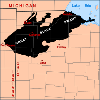
Defiance, on the Maumee River, was near the center of the Great Black Swamp
The Great Black Swamp was a glacially fed wetland in northwest Ohio extending from Lake Erie southwest up the Maumee and Portage River watersheds nearly to Fort Wayne, Indiana. The vast Swamp was a network of forests, wetlands, and grasslands. In the flattest areas, deciduous swamp forests were characterized by ash, elm, cottonwood and sycamore trees. In medium height areas, beech, maples, basswood, and tuliptrees were dominant. On elevated beach ridges, such as the area on which Fort Defiance was built at the confluence of the Maumee and the Auglaize Rivers, oak and hickory trees were dominant. There were no conifers.
Although much of the area to the east, south, and north were settled by the early 19th century, the dense habitat and difficulty of travel through the swamp delayed its development by several decades.
The Great Black Swamp
General "Mad" Anthony Wayne
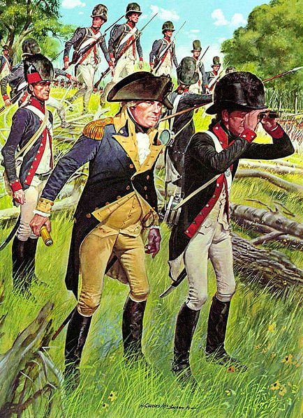
The life of Fort Defiance during and after the War of 1812
Fort Defiance was built in August of 1794 under the direction of General "Mad" Anthony Wayne at the confluence of the Auglaize and Maumee Rivers. Following the Battle of Fallen Timber, Wayne used Fort Defiance as his base of operations. Until the War of 1812, Fort Defiance was one of the westernmost outposts in Ohio.
The Fort was abandoned in 1815.
Truman Weston built a small cabin and blacksmith shop just up the Auglaize river from the fort area. He was only able to bring along two bred mares when they first arrived. Most of the few folks around walked, they did not have horses. He actually enjoyed the solitary life and the occasional visit. He was soon accepted as one of them by the others around, and found ways to make himself useful to them with his skills. Among those friends was a man named John (Johnny) Chapman who went around the region planting apple orchards. At the time, he lived on the north bank of the Maumee nearby one of his orchards. Existing apple orchards were highly desirable by arriving pioneers. He dedicated his life to this activity. Some folks began to call him Johnny Appleseed.
Each year, in these early years, Truman was able to sell a horse. Twice a year he returned to Piqua, and each time, returned with two more of his horses from the family ranch.
According to "A history of Northwest Ohio" by Nevin Otto Winter (see Google Books): "Among the first, if not the very first, real settlers who established themselves in the neighborhood of Fort Defiance were two brothers, by the name of John and William Preston, who had service in the War of 1812. William Preston became the first sheriff in this part of Ohio and finally removed to Williams County… His surname is perpetuated at Defiance in the name of an island and also of a small creek."
Indian Traders
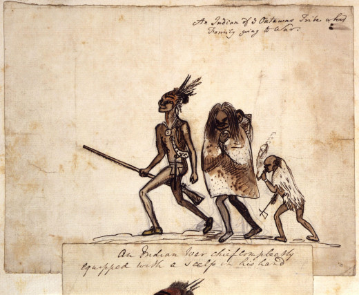
Those who arrived to trade at the Preston's Old Fort Defiance trading post
Ottawa Indians, commonly called Tawah, (also, known as "Odawa" meaning "traders") brought their skins of the otter, beaver, raccoon, bear, muskrat, mink, fox, wild-cat and deer, along with beeswax, ginseng, cranberries and gooseberries. All travel from Fort Wayne to Defiance to Detroit passed along the Maumee, including mail and supplies required from the outside, in those early years. Four French families lived in cabins on the Maumee above the point. A handful of American families had settled along the upper Auglaize and down river on the Maumee.
In 1819, William Travis, a pioneer of Noble Township visited the area and found seven cabins occupied in addition to the Preston's at their trading post, which he recorded in his journal. John Preston died, after a brief illness, shortly after Mr. Travis departed.
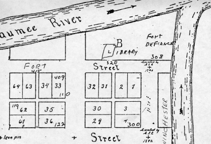
Plan of Fort Defiance
The Butler family, from the Florida area on the Maumee, downriver, were regular visitors
John Butler, his wife, Lena, daughter Asenath, and three sons, became regular visitors to the Preston trading post by 1820. They were a great comfort to William following the death of his brother, John. The Butlers had been living near Fort Detroit prior Hull's surrender. They were among those who were allowed to escape the hostile Indians by the surrender.
Asenath was 17 years old in 1820. The marriage of William Preston and Asenath Butler on the 7th of December, 1820, is shown in the records of Wood County, Ohio, which was responsible for the administration of the Defiance area during 1820.
Little is know of Lena or the Butler sons but John Butler and William Preston entered into a long standing relationship as well as becoming in-laws.
Learn more about Defiance County, Ohio
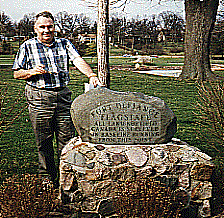
Your author at Defiance flag pole and marker
The arrival of the Shirley family marked the beginning of "civilization" to Defiance
From the Annuls of the Townships, in Valley of the Upper Maumee River, Volume 1: "In the spring of 1822 Robert Shirley, sr., and family moved from near Chillicothe, Ohio to Fort Defiance. The family included the mother, Mrs. Rachel Shirley, and the children, James, Elias, Robert, Ruth, Mary, Nancy, and John G. From Fort Jennings to Fort Defiance they saw no white people, and followed the Indian trail along the river Auglaize. The fort at Defiance, built by Gen. Winchester, was then standing, in a good state of preservation, in charge of William Preston, the only other inhabitant of Defiance. Four French families lived in cabins on the Maumee above the point, and three American families on the Auglaize near by." Also from the Shirley diaries: "There were two good log houses in the fort built for the officers, one of which William Preston's family occupied; in the other, my father's family found narrow but quite comfortable quarters. The fort was all standing in good preservation… Very few white people lived in that vicinity at the time of our arrival."
The Town of Defiance was laid out in November 1822, and recorded in April 28, 1823. The original plat embraced 150 lots, and was located at the confluence of the Maumee and Auglaize, with Jackson street on the west and Fourth street on the south. The Old Fort Ground was a public donation.
The first election of county officers was held on April 8, 1824. For Sheriff, James Shirley, 14 votes, for William Preston, 48 voltes, Preston prevailed. Preston was re-elected two years later in 1826.
On the first day of February, 1826, the county sold additional lots, at auction, in Defiance that they had been allocated to raise funds to operate the county. Among the lots sold were: Lot No.4 to William Preston for $80 and Lot No. 61 to Robert and Nathan Shirley, for $77.
In February 1826, Asenath gave her husband, William, a son. They named him Charles William Preston, but called him Billie. A daughter, Alice, followed in the fall of 1827.
In the spring of 1828, Sheriff Preston declined to run for re-election and a few months later, moved his family to a farm in St. Joseph Township, a few miles to the northwest.
Lot No. 4 and 61 can be seen at lower right and left
Site of old Fort Defiance - author's visit

Historical note by the author
This story contained a little more historical information than most of the stories in this series. Except for Truman Weston, all characters were actual historical figures, uses here fictitiously. Truman Weston is a fictional character. William and Asenath Preston were the 2nd great-grandparents of the author.


